
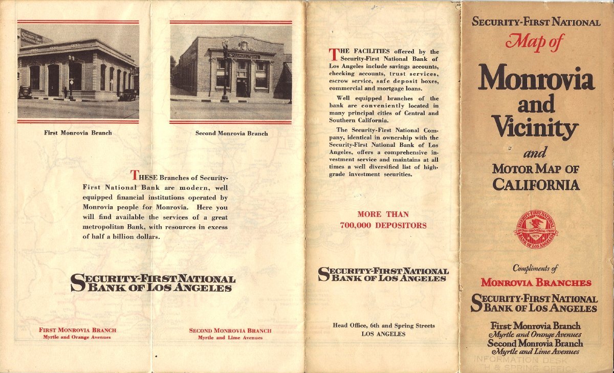
A 1930 road map published by Security-First National Bank showing two of the bank's branch offices, at Myrtle and Lime and Myrtle and Orange (now Colorado). If you click through, it also shows a street map, motor routes and street index for Monrovia and Arcadia, and a motor route map of the state of California. From the Myron Hotchkiss collection. See full details here.
In case anyone is curious why there were two branches, they belonged to independent banks that were each acquired in 1924 by Security Trust & Savings Bank, predecessor of Security-First:
ReplyDeletehttps://cityofmonrovia.pastperfectonline.com/archive/DACD413D-8D89-4F3E-8BAA-154928039000
https://cityofmonrovia.pastperfectonline.com/archive/A5EBC9F2-C78A-4AFC-85DD-537285210674
The First Monrovia Branch, originally the First National Bank of Monrovia, at the northeast corner of Myrtle and Orange (now Colorado), was demolished in the 1950s:
https://cityofmonrovia.pastperfectonline.com/photo/803DAB54-42FA-4FC7-B392-487844264623
The Second Monrovia Branch, originally the Monrovia Savings Bank, is today Basin 141, 402 S. Myrtle Avenue. The façade has changed but the roofline is similar.